
Airborne Geophysical Methods
Four approaches connect the physical property of the target with a suitable measurement layout. Select a method to explore how it works.
Airborne geomagnetics
Map geological magnetic contrasts for mineral exploration.
Explore the method 02 / Electrical conductivity contrastsAirborne radio electromagnetics
Use existing transmitter signals to investigate lateral changes, tectonic structures and suitable pipeline targets.
Explore the method 03 / Subsurface electrical conductivitySemi-airborne electromagnetics
A controlled ground source and airborne induction coils support mineral, geothermal and groundwater exploration.
Explore the method 04 / Detailed magnetic anomaliesMulti-sensor magnetics
Multiple magnetometers sample closely spaced positions for UXO, buried ferrous objects and suitable infrastructure targets.
Explore the methodStart with the investigation objective
A useful survey begins with the question the measurements need to answer. Geological mapping, locating buried objects and investigating electrical contrasts require different combinations of method, coverage and spatial detail. Existing maps, previous investigations and information about the site help define the target and identify practical constraints. The survey design then connects the physical property being measured with the area to be covered and the outputs needed for the next project decision.
Magnetic surveys
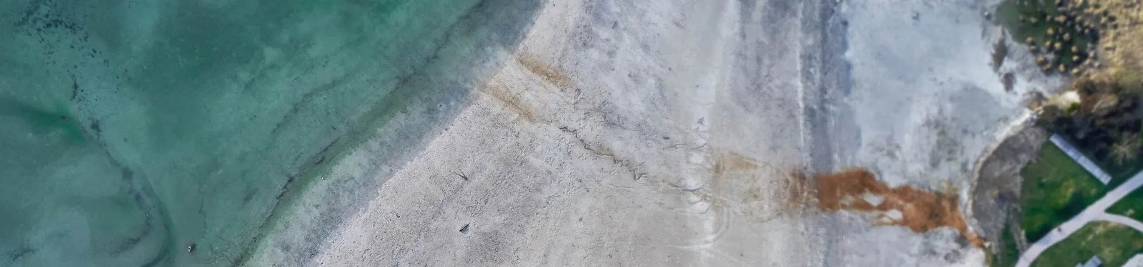
Magnetic sensors record variations in the magnetic field. These measurements support investigations of magnetic geological contrasts and buried ferrous objects. MGT’s portfolio includes single-sensor and multi-sensor configurations. The choice depends on the investigation objective and the required measurement layout.
Single-sensor configurations
A single magnetometer can be used to acquire magnetic measurements along planned survey lines. The survey geometry is selected to match the target and required spatial detail.
Sensor clearance and line spacing are considered together: the configuration should capture the variation of interest across the survey area. Nearby infrastructure and other sources of magnetic interference also need to be considered when planning the measurement layout.
Multi-sensor magnetics
Multiple sensors provide measurements at different positions within the sensor arrangement. Their geometry, spacing and distance from the target are considered as part of survey design.
The purpose of a multi-sensor arrangement is to sample the field at several positions. A suitable arrangement depends on the size and character of the target, rather than simply on the number of sensors. Positioning and consistent acquisition are part of making those measurements useful for interpretation.
MGT describes terrain-following navigation to maintain consistent sensor clearance above the ground. Close-spaced acquisition supports the mapping and follow-up assessment of shallow magnetic targets.
Semi-airborne electromagnetics
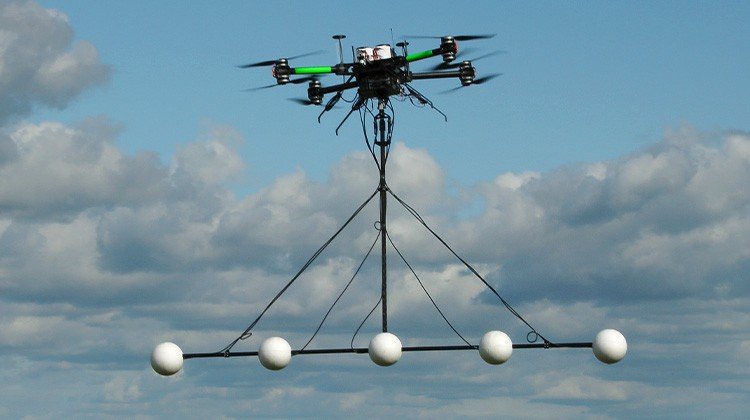
Semi-airborne electromagnetics combines a controlled ground-based source with receivers carried by a drone. At MGT, this approach uses a grounded electrical dipole and airborne induction coils. Measurements of the electromagnetic response are used in processing and inversion to investigate subsurface electrical conductivity. Source geometry, measurement frequencies, ground conditions and signal quality influence the depth and detail that can be resolved. The receiver is airborne, while the source requires access on the ground. Both parts are included when planning the investigation.
From source to subsurface response
The source establishes the excitation; the airborne receiver records the response along the survey lines. The source and receiver positions therefore form one measurement geometry, even though they operate on different platforms. Interpretation brings those measurements together with the survey geometry and geological context. Electrical contrasts can support an investigation, but they need to be assessed alongside other site information before they are associated with a particular material or target.
Radio electromagnetics
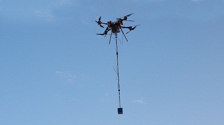
Radio electromagnetic measurements use signals from existing transmitters to investigate the subsurface response. Survey suitability depends on the available signals, their geometry and local conditions. This differs from semi-airborne EM, where the survey uses its own controlled source on the ground.
Multicopter and fixed-wing platforms
The flight platform is selected in relation to the sensor payload, survey geometry and operating environment. Multicopter and fixed-wing configurations offer different flight characteristics and practical requirements. Contact MGT to discuss the currently available configurations for your survey or system enquiry.
Plan the platform around the measurement
Terrain, access, obstacles and the intended line layout influence how a survey can be acquired. Sensor separation, payload integration and flight planning are considered as a connected system so that the platform supports the measurement objective. The practical discussion starts with the site and target. It then establishes a suitable configuration, the planned coverage and any constraints that affect acquisition.
Positioning and integration
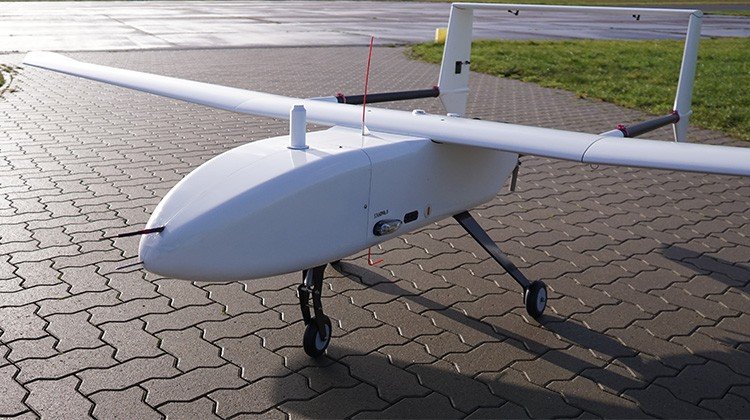
MGT describes RTK positioning for precise measurement locations, with geophysical sensors integrated on multicopter and fixed-wing platforms. Its published fixed-wing platform description lists a payload capacity of up to 5 kg and endurance of up to 3 hours; the applicable configuration is established for each project.
Which approach fits the task?
| Investigation | Method to discuss | Important planning factors |
|---|---|---|
| Magnetic geological contrasts | Magnetic survey | Geological setting, survey height and line spacing |
| Buried ferrous objects | Detailed magnetic survey | Target properties, sensor clearance and interference |
| Subsurface electrical contrasts | Semi-airborne EM | Source access, geometry, geology and target depth |
| Suitable targets using existing transmitter signals | Radio EM | Signal availability, orientation and local conditions |
Our airborne sensor systems
From a single magnetometer to a fixed-wing EM platform: these are the five configurations described in MGT’s published system portfolio.
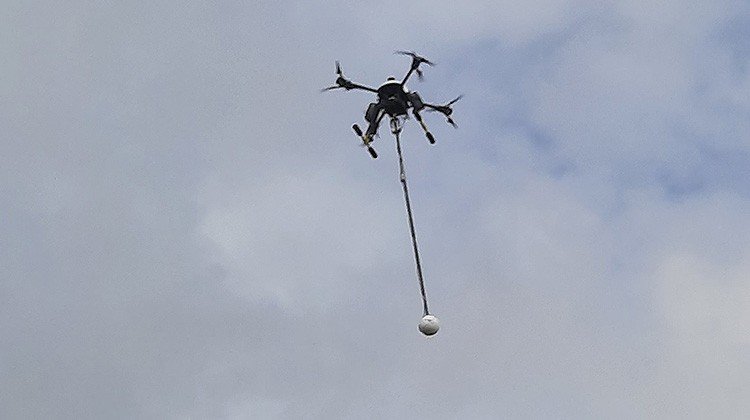
Single Mag System
- Platform
- Octocopter · 10 kg MTOW
- Sensor
- 1 fluxgate magnetometer
- Published production
- Up to 2.5 km² / day
- Survey basis
- 50 line km · 50 m line spacing
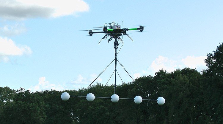
Multi Sensor Mag System
- Platform
- Octocopter · 10 kg MTOW
- Sensors
- Up to 5 fluxgate magnetometers
- Published production
- Up to 10 ha / day
- Survey basis
- 50 line km · 2 m line spacing
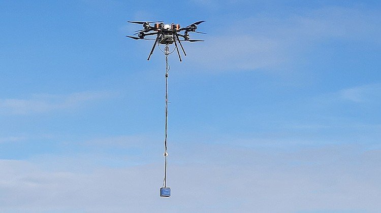
Electromagnetics System
- Platform
- Octocopter · 25 kg MTOW
- Payload
- 1 EM system
- Published production
- Approx. 60 line km / day
- Configuration
- Ground source + airborne receiver

Fixed Wing Electromagnetics
- Platform
- Fixed-wing · 25 kg MTOW
- Payload
- Electromagnetics / geomagnetics
- Published production
- Up to 500 line km / day
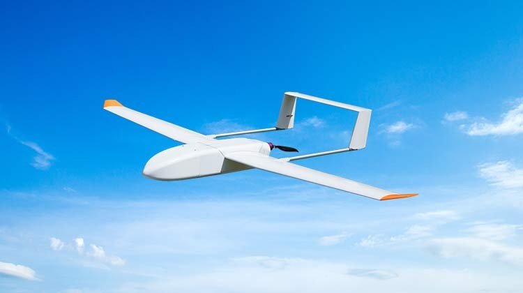
Fixed Wing Mag System
- Platform
- Fixed-wing · 5 kg MTOW
- Sensor
- 1 fluxgate magnetometer
- Published production
- Up to 5 km² / day
- Survey basis
- 100 line km · 50 m line spacing
MTOW means maximum take-off weight, including the aircraft and payload. Published production figures describe particular survey layouts; actual coverage depends on site conditions and acquisition requirements.
Technical figures: MGT’s published system portfolio. Platform background: MGT Technology.
Discuss a survey systemSystems for your own survey operations
MGT develops and supplies geophysical measurement systems for airborne use. If you are planning your own survey capability, tell us about the application, intended platform and required outputs. We can discuss the relevant configuration and current availability. The scope of supply, integration responsibilities and supporting services should be established in the individual proposal.
Define the complete measurement workflow
A system enquiry should also establish how measurements will be positioned, recorded and passed into processing. Intended survey conditions, the available platform and the required deliverables provide a useful starting point for that discussion. Agreeing these interfaces early helps connect the equipment configuration with the work it needs to support, from acquisition through to interpretation.
Technical documentation
Explore the available method overviews and contact MGT for configuration-specific information.